
Shenzhen, June 5, 2026 (GLOBE NEWSWIRE) — PART3DCAMa developer of professional SLAM LiDAR scanning solutions, today announced the release of SHARE PointClouds Studio V2.5.0, featuring a comprehensive AI Engine Algorithm Upgrade that addresses the entire workflow, from spatial capture to professional project results.
The release addresses a challenge that has become central to the architecture, engineering, construction and renovation industries: as 3D scanning has become faster and more accessible, the bottleneck has shifted from capturing spaces to making captured data usable. SHARE PointClouds Studio V2.5.0 is designed to close that gap by connecting SLAM LiDAR scan data to the downstream workflows that design, documentation and construction delivery actually requires.
The workflow problem this solves
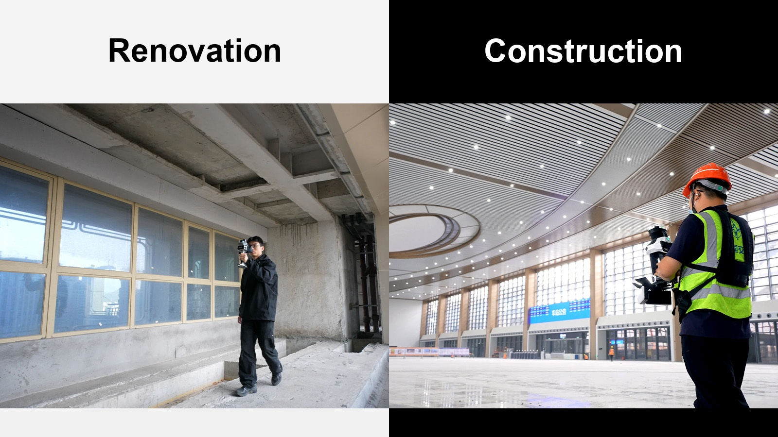
In renovation and construction environments, measurement accuracy is fundamental. Design proposals, cost estimates, material quantities and construction coordination all depend on reliable location data. Traditional measurement workflows – tape measures, manual notes, hand-drawn floor plans – are slow, error-prone and difficult to verify afterwards.
SLAM LiDAR scanning has made site capture faster and more comprehensive. But until recently, the point cloud data produced by these devices remained difficult to integrate directly into design and construction workflows without significant manual processing. Teams export data, import it into third-party software, draft from scratch, and cross-reference repeatedly – a process that reintroduces many of the inefficiencies that scanning should have eliminated.
SHARE PointClouds Studio V2.5.0 and the AI Engine Algorithm Upgrade address this by processing, filtering and transforming scan data into output that can go directly to design, customer communications and project handover – without leaving the SHARE3DCAM ecosystem.
AI-assisted CAD concept generation
The key new capability in this software upgrade is AI-enabled CAD concept generation from point clouds within SHARE PointClouds Studio. The system uses trained AI models to automatically identify structural elements within the captured point cloud data – walls, openings, columns and spatial boundaries – and generate floor plans and section drawings based on actual site geometry. These drawings can be exported as DWG files with point cloud underlays, allowing architects, designers and surveyors to open them directly in AutoCAD or compatible CAD tools for refinement and further development.
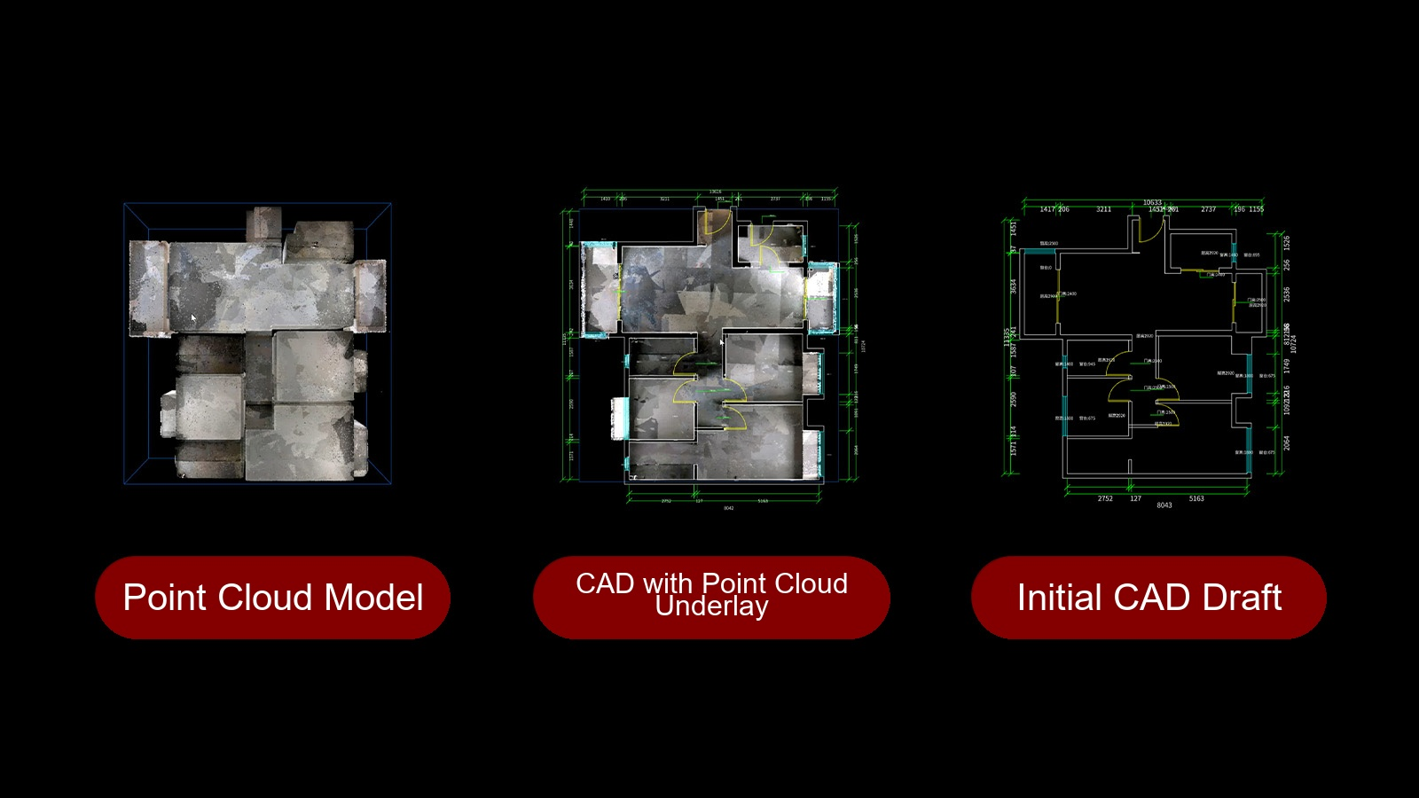
The practical effect is a significant reduction in manual drawing workload. Rather than drawing from scratch based on field measurements and notes, professionals work from a baseline that already reflects actual site conditions. For renovation projects – where design, pricing, contractor briefing and construction coordination all depend on measurement accuracy – this reduces both the time required to produce usable drawings and the risk of errors caused by gaps in manual data collection.
The capability also reduces the number of return visits to the location. When the point cloud acts as a permanent, editable reference layer within the CAD environment, questions that previously required a return trip to the site can often be resolved by re-examining the captured data.
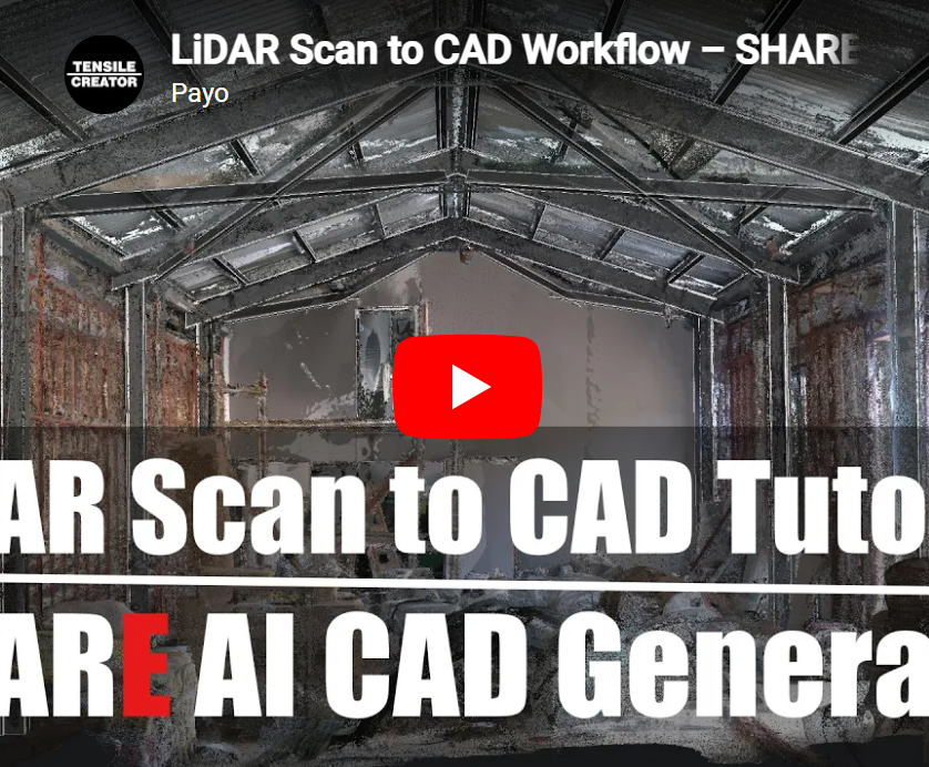
https://www.youtube.com/watch?v=KEKvEhuGEx4
Native 3D Gaussian splatting for spatial communication
SHARE PointClouds Studio V2.5.0 introduces proprietary 3D Gaussian Splatting (3DGS) technology, one of the most important developments in spatial data visualization in recent years.
3D Gaussian Splatting generates representations that feel continuous and spatially intuitive, and closer in character to what a person would experience if they were standing in the space itself. For renovation and construction projects, this improves communication between technical and non-technical team members: clients can more clearly understand spatial layout, structural relationships and design intent; contractors can better visualize conditions before mobilizing; project owners can assess progress against documented site conditions.
What differentiates the 3DGS implementation from SHARE3DCAM is the data fusion from multiple sources. Most Gaussian splat approaches rely primarily on image-based reconstruction, which can produce unstable or geometrically inaccurate results in low-texture environments—precisely the conditions most common in renovation and construction environments, including unpainted concrete, plain plaster walls, and uniformly finished interior surfaces.
By combining LiDAR geometry with visual image data, the implementation of SHARE3DCAM maintains structural accuracy in these environments, producing Gaussian models with more reliable geometry and stable spatial relationships – suitable for professional documentation, stakeholder coordination and customer presentations.
https://www.youtube.com/watch?v=r0tX9UcLAr8
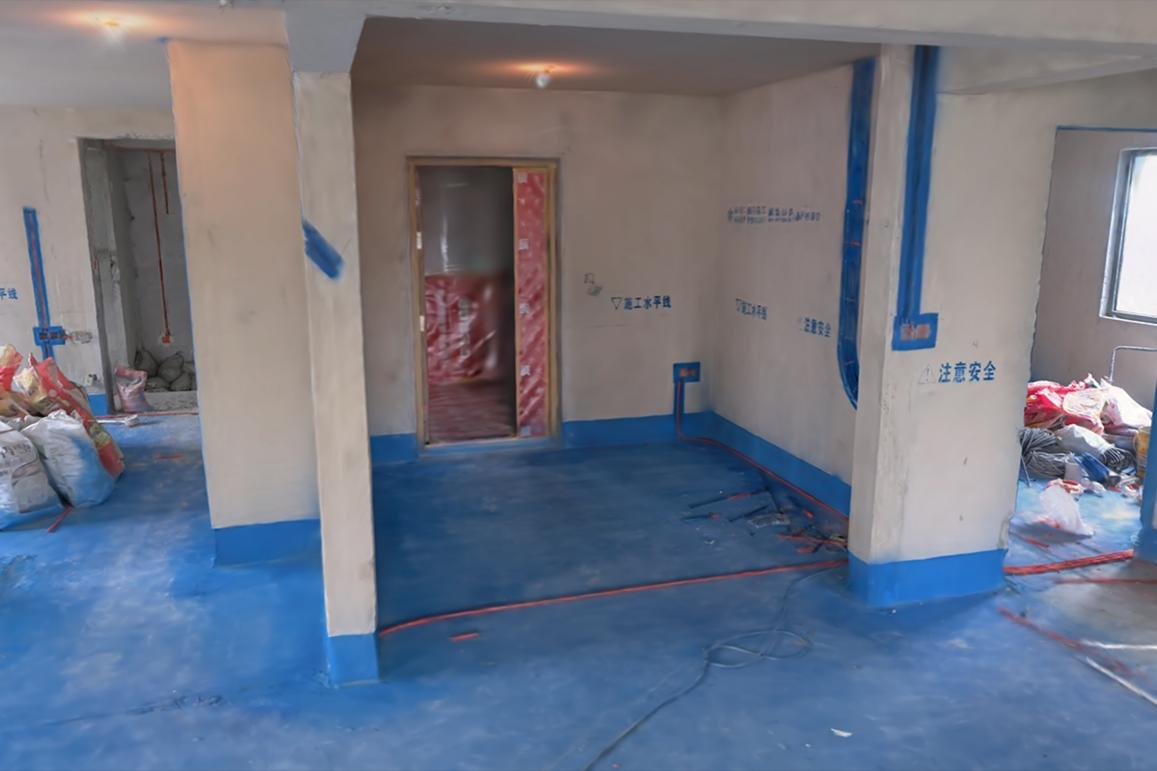
Point Cloud Processing: Built for real job sites
Construction and renovation environments present consistent challenges for spatial data capture: low and uneven lighting, highly reflective surfaces, active personnel and complex geometry. The AI Engine Algorithm Upgrade includes targeted improvements for each of these conditions.
A new color algorithm improves the accuracy of image-to-point-cloud color mapping, taking advantage of the large CMOS sensors in SHARE3DCAM’s scanner hardware to produce more natural color reproduction in low-light environments, including basements, underground parking garages and indoor spaces without natural light.
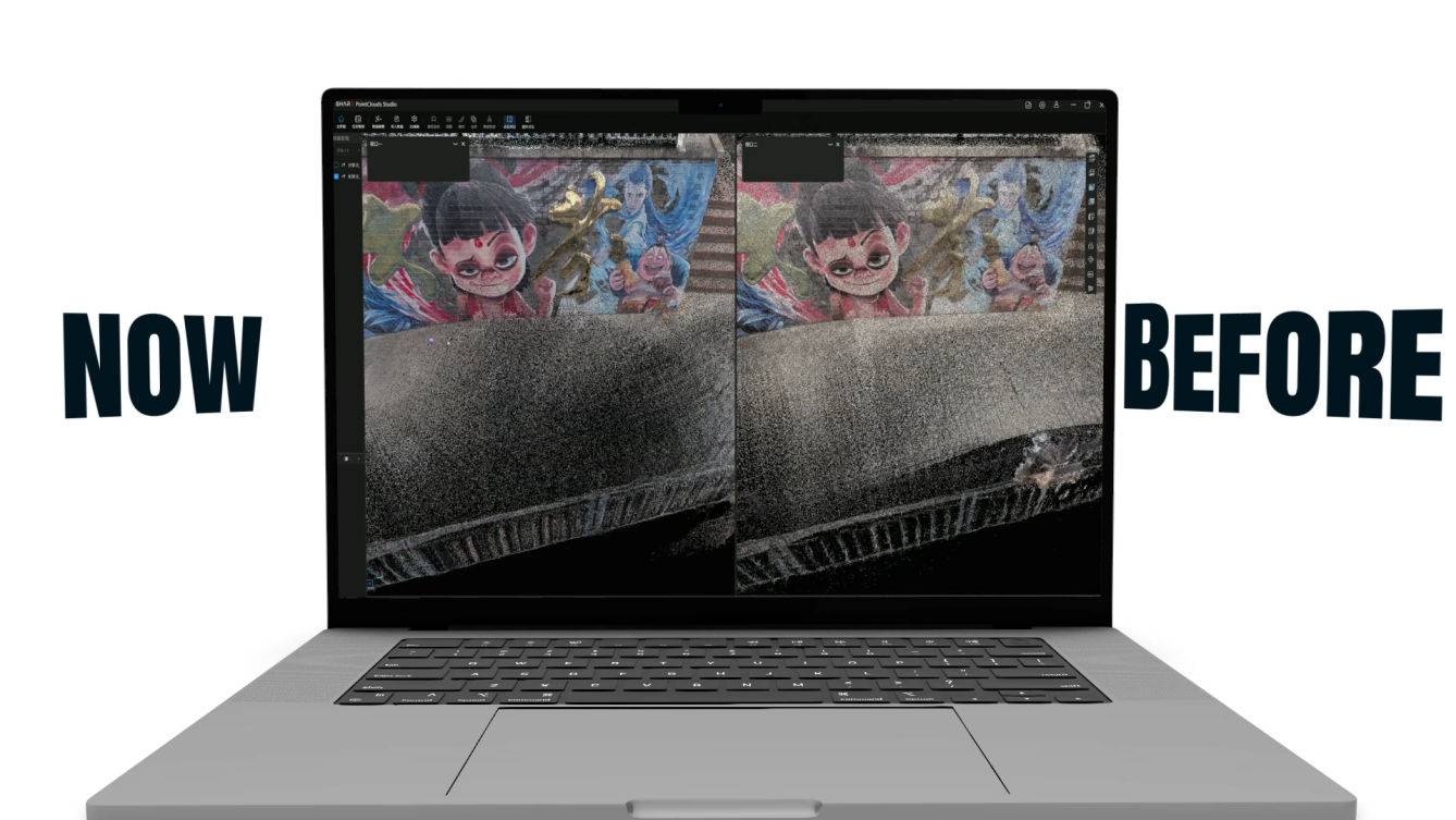
An upgraded intelligent filter algorithm can optimize point cloud thickness down to 5mm in applicable scenarios, reducing data volume and noise while preserving geometric details relevant for measurements and documentation. For reflective materials – glass facades, polished floors, metal surfaces, mirror finishes – the algorithm identifies and helps reduce the spurious geometry that standard processing approaches often retain, improving measurement reliability for spaces where these materials are common.
A proprietary neural network AI model enables dynamic object removal and figure segmentation. When personnel or equipment are present on site during scanning, the system can extract useful spatial data without having to completely clear the space – a practical operational advantage on active construction sites where repeated clearing causes delays and disrupts ongoing work.
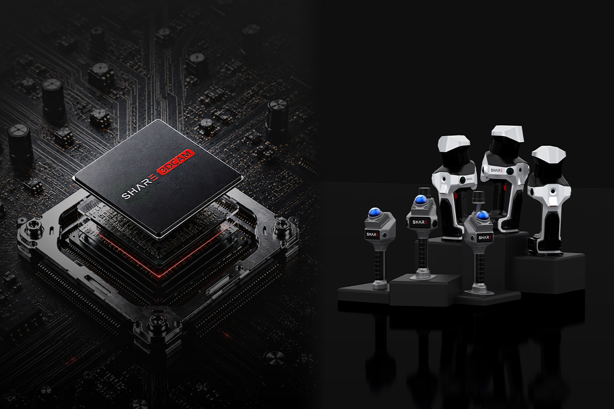
Hardware ecosystem: scanners designed for every scale
SHARE PointClouds Studio V2.5.0 is designed to work natively with SHARE3DCAM’s SLAM scanner family, providing an integrated workflow from location capture to deliverable output.
The SHARE C1 offers professional spatial capture capabilities in a more compact and flexible form factor, suitable for professionals who need to quickly deploy to multiple location types or work in confined environments.
The PART SLAM S20 is designed for seamless data collection in renovation, architectural measurements and complex AEC workflows. Its compact and portable design is optimized for navigating complex or inhabited environments, making it the go-to tool for professionals working on a variety of residential and commercial projects.
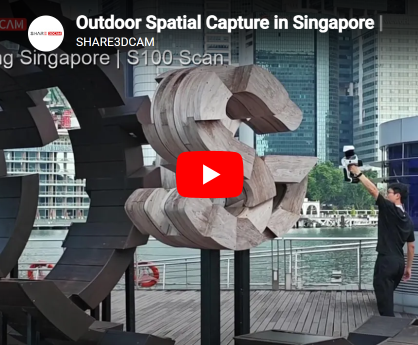
For larger scale requirements – engineering surveys, inspection of industrial facilities, complex infrastructure and large outdoor environments – the SHARE SLAM S100 Series is designed to handle higher data volumes, longer distance recording and more demanding operational conditions.
Together, the hardware suite and SHARE PointClouds Studio 2.5 form a complete spatial data ecosystem: capture on site, process and output in software, deliver to the customer.
Beyond the scan
“Capturing spaces is no longer the challenge – making that data usable is,” says Enzo Fan, CEO of SHARE3DCAM. “Any project team that scans a space should be able to bring that data directly into their design, coordination and delivery workflow. The AI Engine Algorithm Upgrade is about bridging the distance between the scan and the result – and ensuring that distance continues to close with each release.”
Availability
SHARE PointClouds Studio V2.5.0 is now available through SHARE3DCAM’s official channels.
SHARE PointClouds Studio is offered as free desktop software with no subscription fees, time limits or licensing fees. Professionals have permanent access to the full feature set at no cost, including the AI Engine Algorithm Upgrade capabilities introduced in version 2.5.
More product information
Official website: http://www.share3dcam.com
E-mail: [email protected]
About SHARE3DCAM
SHARE3DCAM is a Shenzhen-based developer and manufacturer of professional SLAM LiDAR scanning solutions. Through its scanner hardware – including the SHARE SLAM S20, SHARE C1 and SHARE SLAM S100 series – and the SHARE PointClouds Studio software platform, SHARE3DCAM serves professionals in surveying, AEC, renovation, industrial inspection and spatial digitalization, allowing teams to capture real-world environments and transform them into accurate, actionable spatial data.
